Tornado warning issued for McCreary as parts of Manitoba under severe thunderstorm warning
Posted June 2, 2026 3:36 pm.
Last Updated June 2, 2026 6:44 pm.
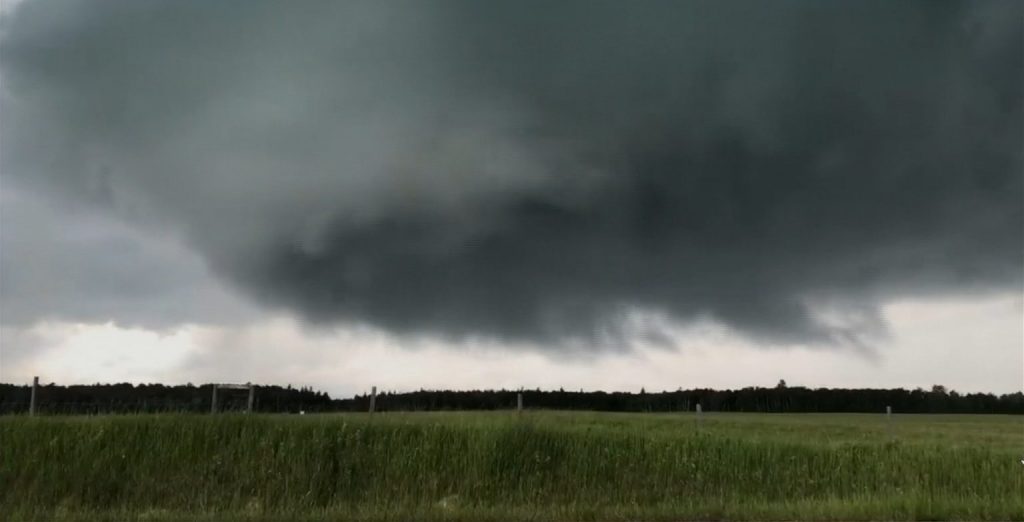
Environment Canada has issued a red-level alert for a possible tornado for the Municipality of McCreary, including Norgate.
Meteorologists are tracking a severe thunderstorm in the area that is northwest of Winnipeg, near Riding Mountain National Park, that has the possibility of producing a tornado.
The area may also face damaging winds, large hail, and locally intense rainfall.
As of 3:03 p.m., the thunderstorm was west of Laurier and moving northeast at 25 km/h.
“With the ingredients that we have — the moisture, the heat, the energy — all severe weather threats are really on the table. Larger hail and even the chance of some tornadic activity through the south of the province. Again, not the main threat we’re expecting, but still that risk is there,” said Christy Climanhaga, a scientist with Environment and Climate Change Canada.
“We do have a good environment for some severe weather, especially southwestern Manitoba. Close to Winnipeg, you’re right on the edge of that big risk area.”
If the storm does produce a tornado, seek shelter immediately in a basement, interior room, or a sturdy shelter when threatening weather approaches. If no shelter is available, lie in a low spot and protect your head from flying debris.
If you are out on the water when threatening weather approaches, return to shore and seek shelter, if possible. Otherwise, move away from the path of the tornado to escape. Wear your lifejacket, lie face down and protect your head.
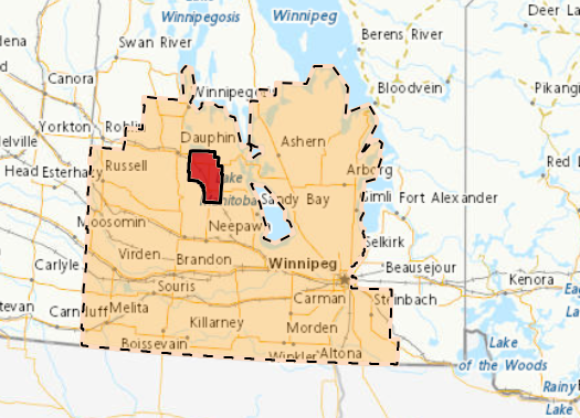
Orange level severe thunderstorm warning
Winnipeg and various parts of southern Manitoba are also under an orange-level severe thunderstorm warning.
Meteorologists say 30 to 50 mm of rain is expected in some areas with potential wind gusts nearing 90-120 km/h.
The storm was being tracked from southeastern Saskatchewan into southwestern Manitoba.
It is possible that the storm could produce large hail, strong gusty winds, and heavy rainfall.
Winnipeg could see storms move through between roughly 7 p.m. and 9 p.m.
Forecasters are encouraging Manitobans to keep an eye on watches and warnings throughout tonight, with the threat of strong winds, heavy rain, hail and lightning expected to continue overnight. Environment Canada says another round of thunderstorm activity is also possible Wednesday as unsettled conditions remain across the region.
-With files from Mitchell Ringos