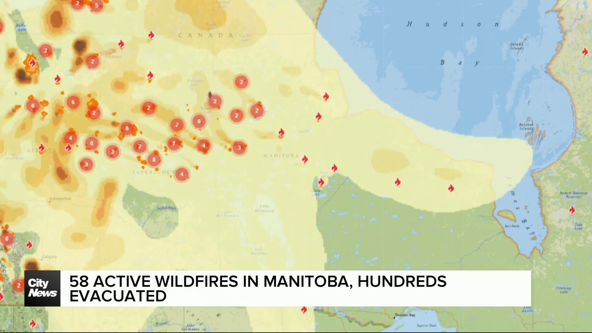
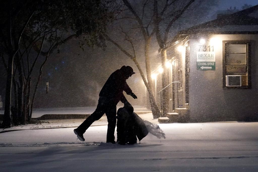
Snow set to blanket Winnipeg as March arrives
Posted March 1, 2024 2:52 pm.
If you’re outside enjoying the warm weather, the bad news is it’s coming to an end. Environment and Climate Change Canada is forecasting a Winter storm will wallop Winnipeg and the surrounding areas over the weekend, bringing with it up to 40 cm of snow.
A special weather statement for the City of Winnipeg indicated alongside snow, the storm could also bring with it rain, freezing rain, and “even a few rumbles of thunder.”
Meteorologist Brian Proctor a meteorologist says while the snowfall will likely be the biggest the city has seen all winter, it’s not uncommon for more extreme events to take place on the edges of the season. But he says people have to plan ahead and maybe reconsider any weekend plans.
“Be prepared. Listen for updated weather watches, warnings, things of that nature. As the weekend moves along, conditions are going to get worse for the area,” said Proctor.
“It’s definitely going to be one of the heavier snowfalls of the winter at this point and time, there’s no really doubting it’s going to be a fairly significant and impactful system.”
Proctor says the weather, coming from the west coast into the prairies, is being caused by a low atmospheric pressure system — known as a trough — bordered by warmer temperatures, bringing it with a myriad of weather conditions.
“One of the really interesting things we see with the really sharp temperature contrasts on these systems, is we see highly variable amounts of snowfall associated with these systems.”
But Proctor says the snow is needed to help address concerns around drought and wildfires in the warmer seasons ahead.
“Climate Change alone does not make an extreme weather event, Climate Change is just one factor that amplifies certain extreme weather events.”
Climatologist Alex Crawford says global warming and climate change are playing it’s part in the stranger season that’s been hitting the region, one of the warmest on record, and he says it’s likely things will only get worse.
“This particular El Nino is happening at the same time that the entire North Atlantic Ocean is a lot warmer than normal, and it’s also happening at the same time we have this long-term trend of global warming, so what that means now is the El Ninos we get nowadays, tend to be warmer than they were in the mid-20th Century, or even the 19th Century,” explained Crawford.
Crawford says a winter storm in March is normal, but what it might be bringing in the form of freezing rain, is a sign of things to come unless there’s drastic changes around political will and the global economy.
“The only thing that makes a difference is a lot of people — billions of people — making decisions and the only way that happens is with government action.”